University of Minnesota
http://www.umn.edu/
612-625-5000
http://www.umn.edu/
612-625-5000
Minnesota Biodiversity Atlas
Bell Museum
Dataset: MIN-Plants
Taxa: Scirpus cyperinus
Search Criteria: excluding cultivated/captive occurrences
Bell Museum plants | |
 MIN:Plants | 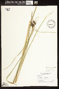 Scirpus cyperinus (L.) Kunth 456494[1106234]Nation, R. 94-3091994-07-18 United States, Minnesota, Mower, Northwest edge of park. SE1/4 of NE1/4 of Section.;Lake Louise State Park;101N;14W;20, 43.536572 -92.538986 |
MIN:Plants | 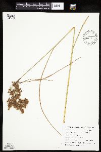 Scirpus cyperinus (L.) Kunth 426914[1021832]DeMink, L. 3771999-08-20 United States, Minnesota, Morrison, Crane Meadows National Wildlife Refuge; NENE 30-T40N-R31W;Crane Meadows National Wildlife Refuge;T040N R31W S30, 45.933896 -94.251565 |
MIN:Plants | 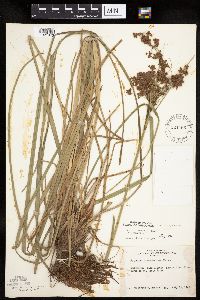 Scirpus cyperinus (L.) Kunth 524466[1021842]Benner, J. s.n.1948-07-15 United States, Wisconsin, Polk, Island five miles north of St. Croix Falls;Saint Croix National Riverway;;;, 45.488738 -92.698239 |
MIN:Plants | 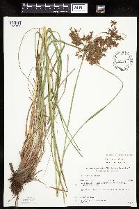 Scirpus cyperinus (L.) Kunth 455108[1021828]Gerdes, Lynden; Gerdes, D. Lawson 31071998-08-10 United States, Minnesota, Cook, Northeast corner of Gunflint Lake; island.;Superior National Forest;065N;02W;19, 48.098709 -90.630416 |
MIN:Plants | 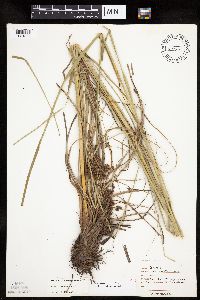 Scirpus cyperinus (L.) Kunth 474216[1021829]Moore, John 2381971-07-08 United States, Minnesota, Sherburne, NW1/4 of section;Sherburne National Wildlife Refuge;035N;28W;19, 45.508388 -93.871722 |
MIN:Plants |  Scirpus cyperinus (L.) Kunth 474177[1021836]Moore, John 18711972-08-00 United States, Minnesota, Sherburne, Sherburne NWR;Sherburne National Wildlife Refuge;;;, 45.490813 -93.721671 |
MIN:Plants | 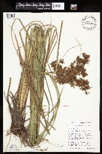 Scirpus cyperinus (L.) Kunth 435668[1021835]Husveth, J. 95-13021995-08-17 United States, Minnesota, Morrison, Morrison Co, T42N R36W SW1/4 of the SW1/4 of S18 [Correction: T42 R36 does not exist].;;;;, 46.012617 -94.268415 |
MIN:Plants | Scirpus cyperinus (L.) Kunth 430160[]Nation, R. 94-2861994-07-18 United States, Minnesota, Mower, Tract 16A. NE1/4 of SE1/4 of section;Lake Louise State Park;101N;14W;20, 43.536572 -92.538986 |
MIN:Plants | 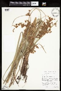 Scirpus cyperinus (L.) Kunth 435793[1021831]Husveth, J. 95-3021995-08-21 United States, Minnesota, Ramsey, Ramsey Co, T30N R23W NW1/4 of the NW1/4 of S2.;;030N;23W;2, 45.116108 -93.137483 |
MIN:Plants | 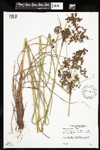 Scirpus cyperinus (L.) Kunth 904800[1021830]Gerdes, Lynden 49262004-08-19 United States, Minnesota, Lake, Superior National Forest. T60N R07W S06 NWSE Lake County ... Superior National Forest. Approximately 7.9 miles NE of Isabella, MN and 0.50 mile SE of Sylvania Lake.. 060N 07W 6, 47.709709 -91.266453 |
MIN:Plants | 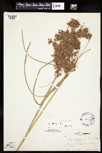 Scirpus cyperinus (L.) Kunth 294809[1021840]Benner, F.; Benner, J. 3691928-09-08 United States, Wisconsin, Polk, 2.8 mi. N. St. Croix Falls, on River Road;Saint Croix National Riverway;;;, 45.452726 -92.649593 |
MIN:Plants | 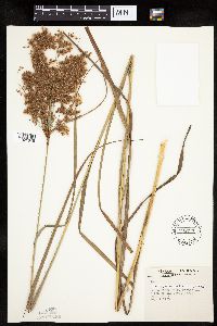 Scirpus cyperinus (L.) Kunth 598791[1021845]Tryon, R. 16821935-08-02 United States, Indiana, Porter, Dunes State Park, Porter Co. W end of the Great Marsh;Indiana Dunes National Lakeshore;;;, 41.663093 -87.032128 |
MIN:Plants | 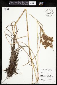 Scirpus cyperinus (L.) Kunth 479141[1021833]Mensing, D. 95-591995-09-08 United States, Minnesota, Chisago, Chisago Co, T36N R20W SE1/4 of the NW1/4 of S30; Goose Creek;Wild River State Park;036N;20W;30, 45.578689 -92.891116 |
MIN:Plants | 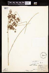 Scirpus cyperinus (L.) Kunth 524704[1021841]Benner, F.; Benner, J. 1071928-08-03 United States, Wisconsin, Polk, Whiskey Creek - 2.7 mi N. St. Croix Falls;Saint Croix National Riverway;;;, 45.495248 -92.699726 |
MIN:Plants | 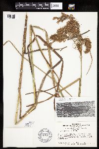 Scirpus cyperinus (L.) Kunth 681383[1021839]Swanson, Steven 19971975-08-04 United States, Wisconsin, Vernon, Mississippi River (Navigation Pool #8) ... Vernon Co, Site 63;Upper Mississippi National Wildlife Refuge |
MIN:Plants | 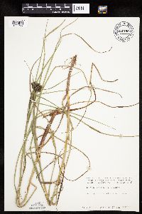 Scirpus cyperinus (L.) Kunth 680190[1021837]Coffin, Barbara 321976-07-10 United States, Wisconsin, Ashland, Presque Isle Point, Stockton Island, Apostle Islands National Lakeshore;Apostle Islands National Lakeshore;;;, 46.916326 -90.548792 |
MIN:Plants | 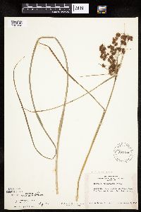 Scirpus cyperinus (L.) Kunth 524423[1021843]Benner, J. s.n.1945-09-02 United States, Wisconsin, Polk, Polk County: St. Croix Falls, 7 miles north near the river road;Saint Croix National Riverway;;;, 45.495248 -92.699726 |
MIN:Plants | 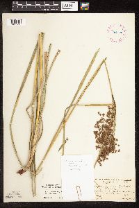 Scirpus cyperinus (L.) Kunth 267788[1106293]Hotchkiss, N. 30831926-08-07 United States, Wisconsin, Buffalo, Buffalo Co. ... Mississippi R. bottoms opposite Wabasha, Minn.;Upper Mississippi National Wildlife Refuge |
MIN:Plants | 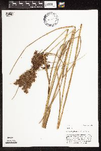 Scirpus cyperinus (L.) Kunth 463543[1106819]Mason, Harriet; Mason, Charles NSP98-1161998-08-25 United States, Minnesota, Rice, In the second most northern open area along the east clearing line; at top of draw into Lips property. SW corner of section;Nerstrand Woods State Park;110N;19W;16, 44.334371 -93.111203 |
MIN:Plants | 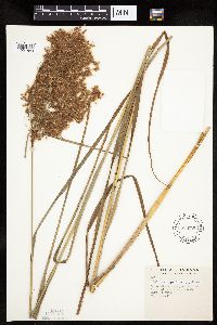 Scirpus cyperinus (L.) Kunth 598790[1021844]Tryon, R. 16761935-08-02 United States, Indiana, Porter, Dunes State Park, Porter Co. W end of the Great Marsh;Indiana Dunes National Lakeshore;;;, 41.663093 -87.032128 |
MIN:Plants | 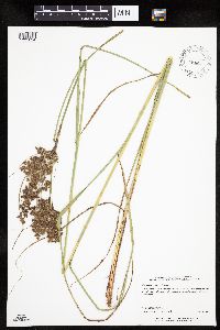 Scirpus cyperinus (L.) Kunth 491329[1021834]Perry, Ethan 20050152005-07-28 United States, Minnesota, Saint Louis, St. Louis County...5.5 miles northwest of Brimson...T56N R13W SWSW14;Superior National Forest;056N;13W;14, 47.335815 -91.952081 |
MIN:Plants | 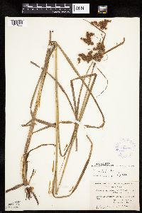 Scirpus cyperinus (L.) Kunth 424279[1021838]Fassett, N.; et al. 54401927-09-03 United States, Wisconsin, Polk, Polk Co. ... Thaxter Lake, Interstate Park, St. Croix Falls;Interstate State Park;;;, 45.389129 -92.657429 |
MIN:Plants | 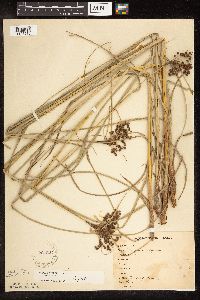 Scirpus cyperinus (L.) Kunth 221227[1106276]Stevenson, J. 1271912-07-09 United States, Minnesota, Beltrami, Bemidji.;;N;;, 47.453829 -94.863614 |
MIN:Plants | 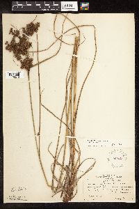 Scirpus cyperinus (L.) Kunth 222021[1106212]Rosendahl, C.; Butters, F. 50791926-08-03 United States, Minnesota, Anoka, NE of Coon Lake.;;033N;22W;, 45.340658 -93.081463 |
MIN:Plants | 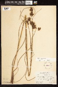 Scirpus cyperinus (L.) Kunth 222022[1106225]Rosendahl, C.; Butters, F. 50791926-08-03 United States, Minnesota, Anoka, NE of Coon Lake;;033N;22W;, 45.340658 -93.081463 |
MIN:Plants | 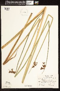 Scirpus cyperinus (L.) Kunth 270959[1106269]Yender, R. 392000-06-29 United States, Minnesota, Saint Louis, Low Lake.;;064N;12W;, 47.972358 -91.828264 |
MIN:Plants | 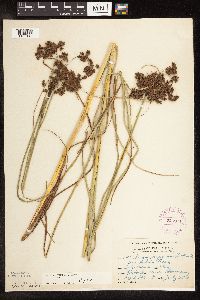 Scirpus cyperinus (L.) Kunth 275971[1106145]Grant, Martin 29111929-07-25 United States, Minnesota, Hubbard, N boundary of Itasca State Park.;Itasca State Park;143N;35W;6, 47.232454 -95.161386 |
MIN:Plants | 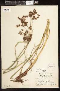 Scirpus cyperinus (L.) Kunth 275973[1106109]Grant, Martin 30581929-08-13 United States, Minnesota, Clearwater, Morrison Lake, Itasca Park;Itasca State Park;143N;36W;34, 47.159541 -95.222656 |
MIN:Plants | 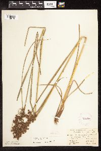 Scirpus cyperinus (L.) Kunth 276692[1106179]Fassett, N.; Hotchkiss, N. 31781926-08-28 United States, Minnesota, Wabasha, Wabasha Co.;;;;, 44.28333 -92.21667 |
MIN:Plants | 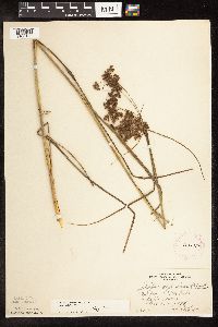 Scirpus cyperinus (L.) Kunth 276768[1106175]Huff, N. 2321914-08-21 United States, Minnesota, Lake, Rice Lake;;N;;, 47.816292 -91.369911 |
MIN:Plants | 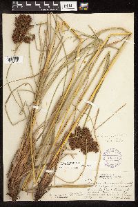 Scirpus cyperinus (L.) Kunth 293129[1106161]Lakela, Olga 10641934-07-26 United States, Minnesota, Saint Louis, Palo, 8 mi S of Aurora;;057N;15W;, 47.415324 -92.239713 |
MIN:Plants | 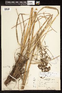 Scirpus cyperinus (L.) Kunth 306689[1106231]Hotchkiss, N.; et al. 27201927-10-27 United States, Minnesota, Anoka, Anoka County...Moore Lake.;;030N;24W;23, 45.071682 -93.257896 |
MIN:Plants | 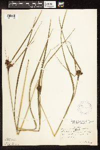 Scirpus cyperinus (L.) Kunth 306690[1106230]Oosting, H. 28551928-06-28 United States, Minnesota, Anoka, Bunker Lake;Bunker Hills County Park;032N;24W;, 45.218819 -93.275736 |
MIN:Plants | 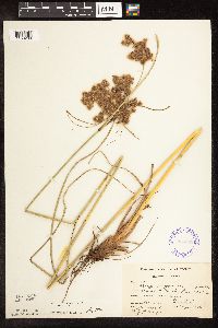 Scirpus cyperinus (L.) Kunth 336602[1106209]Smith, L.; Moyle, J. 1421936-08-06 United States, Minnesota, Itasca, Lucky Lake;Chippewa National Forest;057N;26W;, 47.416436 -93.643253 |
MIN:Plants | 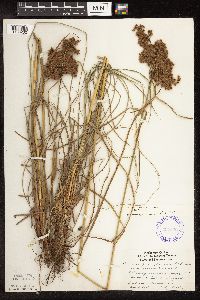 Scirpus cyperinus (L.) Kunth 337620[1106262]Lakela, Olga 16251936-08-04 United States, Minnesota, Saint Louis, Edge of the "barrens", bayside, Duluth.;;050N;14W;13, 46.816041 -92.059779 |
MIN:Plants | 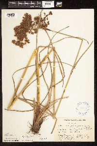 Scirpus cyperinus (L.) Kunth 337784[1106174]Smith, L.; Moyle, J. 3231936-08-19 United States, Minnesota, Cass, Long Lake. T141N R28W;Chippewa National Forest / Leech Lake Indian Reservation;141N;28W;, 47.023603 -94.223385 |
MIN:Plants | 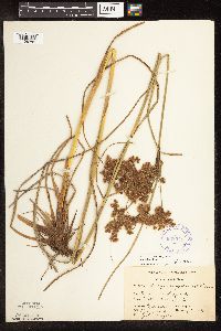 Scirpus cyperinus (L.) Kunth 338071[1106284]Smith, L.; Moyle, J. 3241936-08-19 United States, Minnesota, Cass, Long Lake.;;N;;, 47.023603 -94.223385 |
MIN:Plants | 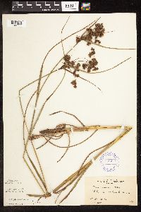 Scirpus cyperinus (L.) Kunth 346693[1106177]Morse, Marius s.n.1937-00-00 United States, Minnesota, Saint Louis, Bates Lake;;N;;, 47.241833 -91.855903 |
MIN:Plants | 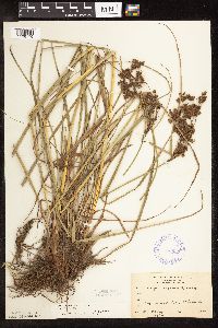 Scirpus cyperinus (L.) Kunth 346698[1106176]Morse, Marius 51937-00-00 United States, Minnesota, Saint Louis, Big Comstock Lake;;N;;, 47.220232 -92.223436 |
MIN:Plants | 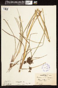 Scirpus cyperinus (L.) Kunth 347324[1106272]Morse, Marius 15 United States, Minnesota, Saint Louis, Little Pequaywam Lake.;Cloquet Valley State Forest;N;;, 47.155272 -91.855943 |
MIN:Plants | 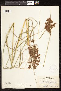 Scirpus cyperinus (L.) Kunth 350704[1106210]Hedman, H. 681938-07-00 United States, Minnesota, Hennepin, N shore of Browns Bay, Lake Minnetonka.;;117N;23W;, 44.934923 -93.584208 |
MIN:Plants | 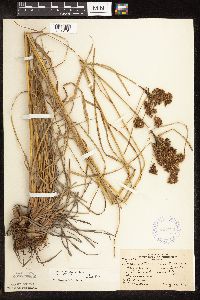 Scirpus cyperinus (L.) Kunth 353730[1106181]Moyle, J.; et al. 1911A1934-08-21 United States, Minnesota, Saint Louis, On the N side of Bass Lake, near Ely.;Superior National Forest;063N;12W;, 47.933092 -91.861065 |
MIN:Plants | 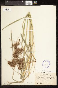 Scirpus cyperinus (L.) Kunth 354662[1106213]Moyle, J.; et al. 18811934-08-20 United States, Minnesota, Saint Louis, Low Lake, 8 mi NW of Ely;Superior National Forest;;;, 47.967669 -92.191235 |
MIN:Plants | 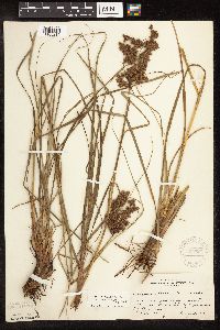 Scirpus cyperinus (L.) Kunth 355727[1106216]Rosendahl, C.; Dahlberg, R. s.n.1918-08-00 United States, Minnesota, Itasca, Grand Rapids;;N;;, 47.215547 -93.522987 |
MIN:Plants | 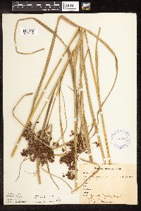 Scirpus cyperinus (L.) Kunth 356961[1106224]Stevenson, J. 3821912-08-28 United States, Minnesota, Itasca, Grand Rapids;;N;;, 47.215547 -93.522987 |
MIN:Plants | 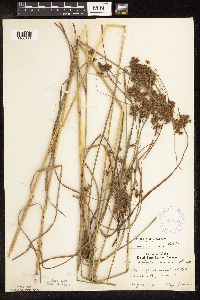 Scirpus cyperinus (L.) Kunth 362584[1106194]Lakela, Olga 41201940-08-18 United States, Minnesota, Carlton, Moosehead Lake;;N;;, 46.46166 -92.740742 |
MIN:Plants | 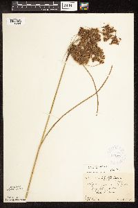 Scirpus cyperinus (L.) Kunth 364066[1106264]Gilbert, H. 4741923-08-24 United States, Minnesota, Saint Louis, Duluth.;;N;;, 46.783273 -92.106579 |
MIN:Plants | 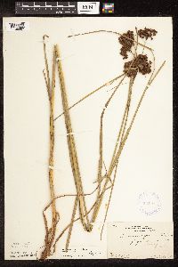 Scirpus cyperinus (L.) Kunth 364067[1106263]Gilbert, H. 2341923-06-25 United States, Minnesota, Saint Louis, Duluth.;;N;;, 46.783273 -92.106579 |
MIN:Plants | 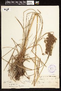 Scirpus cyperinus (L.) Kunth 365287[1106211]Buell, Murray 20061940-08-16 United States, Minnesota, Clearwater, Bohall Lake.;Itasca State Park;143N;36W;, 47.19557 -95.233216 |
MIN:Plants | 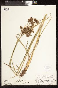 Scirpus cyperinus (L.) Kunth 368698[1106267]Lakela, Olga 47221941-08-09 United States, Minnesota, Lake, On the Isabella-Tofte Rd, ca. 3 mi. E of the jct. of the Ely-Finland Rd.;;N;;, 47.613111 -91.329341 |
MIN:Plants | 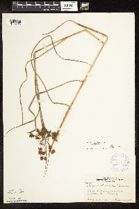 Scirpus cyperinus (L.) Kunth 370599[1106253]Lakela, Olga 41201940-08-18 United States, Minnesota, Carlton, Moosehead Lake.;;046N;19W;, 46.46166 -92.740742 |
MIN:Plants | 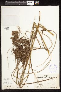 Scirpus cyperinus (L.) Kunth 385784[1106250]Moyle, J. 38351944-08-30 United States, Minnesota, Saint Louis, Tributary to Floodwood Lake;;N;;, 47.168272 -93.035201 |
MIN:Plants | 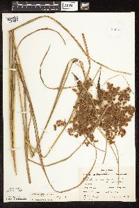 Scirpus cyperinus (L.) Kunth 385857[1106268]Moyle, J. 39071945-08-30 United States, Minnesota, Mower, along road near Grand Meadow;;N;;, 43.705796 -92.572121 |
MIN:Plants | 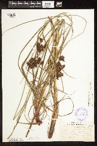 Scirpus cyperinus (L.) Kunth 386092[1106187]Lakela, Olga 57391944-08-14 United States, Minnesota, Lake, Pancake Island in Lake Superior betwen East Beaver Bay and the Palisade. Lake Co.;North Shore;055N;07W;00, 47.278836 -91.274838 |
MIN:Plants | 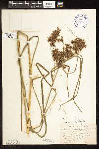 Scirpus cyperinus (L.) Kunth 391879[1106185]Lakela, Olga 61981945-09-06 United States, Minnesota, Lake, Lake County...Beaver Island [Lake Superior], 2 mi E of Beaver Bay;North Shore;055N;07W;05, 47.283575 -91.254452 |
MIN:Plants | 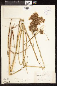 Scirpus cyperinus (L.) Kunth 392945[1106249]Lakela, Olga 73251947-09-02 United States, Minnesota, Saint Louis, Hwy 2, W of Grand Lake;;N;;, 46.847308 -92.496277 |
MIN:Plants | 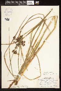 Scirpus cyperinus (L.) Kunth 393453[1106235]Lakela, Olga 70271947-07-29 United States, Minnesota, Saint Louis, Near Skibo.;;058N;13W;, 47.501646 -91.985085 |
MIN:Plants | 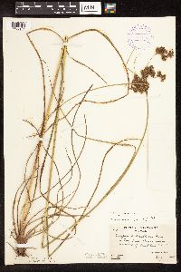 Scirpus cyperinus (L.) Kunth 394693[1106217]Butters, F.; Abbe, E. 9351944-08-04 United States, Minnesota, Cook, Sea Gull River near crossing of Gunflint Trail. Cook Co.;Superior National Forest;066N;05W;, 48.18482 -90.958487 |
MIN:Plants | 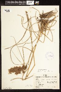 Scirpus cyperinus (L.) Kunth 405446[1106108]Benson, Robert 421941-07-31 United States, Minnesota, Anoka, Carlos Avery Refuge;Carlos Avery Wildlife Management Area;033N;22W;32, 45.304324 -93.111756 |
MIN:Plants | 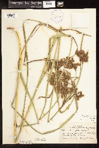 Scirpus cyperinus (L.) Kunth 407376[1106189]Lakela, Olga 98951949-09-15 United States, Minnesota, Saint Louis, Border of a swamp, hwy. 1, S of Ely.;;N;;, 47.850496 -91.840897 |
MIN:Plants | 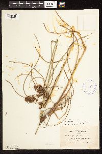 Scirpus cyperinus (L.) Kunth 407413[1106255]Lakela, Olga 93291949-08-13 United States, Minnesota, Saint Louis, Prairie Lake, SW St. Louis Co.;;050N;20W;, 46.809279 -92.870675 |
MIN:Plants | 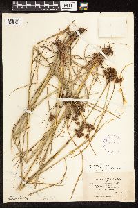 Scirpus cyperinus (L.) Kunth 407479[1106193]Lakela, Olga 93851949-08-14 United States, Minnesota, Saint Louis, Fredenberg Lake;;N;;, 46.987037 -92.191099 |
MIN:Plants | 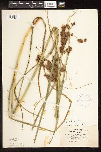 Scirpus cyperinus (L.) Kunth 407510[1106240]Lakela, Olga 93861949-08-14 United States, Minnesota, Saint Louis, Fredenburg Lake.;;N;;, 46.987037 -92.191099 |
MIN:Plants | 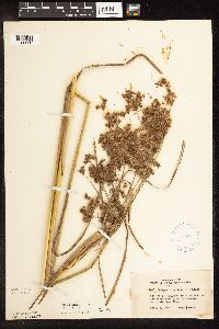 Scirpus cyperinus (L.) Kunth 407641[1106236]Lakela, Olga 96001949-09-02 United States, Minnesota, Saint Louis, On the road to Ash River from Lake Kabetogama.;Kabetogama State Forest;N;;, 48.384121 -92.893614 |
MIN:Plants | 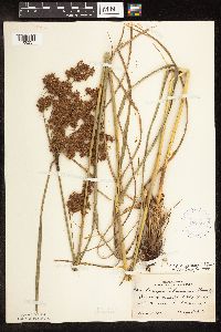 Scirpus cyperinus (L.) Kunth 407755[1106237]Lakela, Olga 93861949-08-14 United States, Minnesota, Saint Louis, Fredenberg Lake;;N;;, 46.987037 -92.191099 |
MIN:Plants | 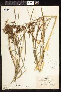 Scirpus cyperinus (L.) Kunth 407810[1106257]Lakela, Olga 93311949-08-13 United States, Minnesota, Saint Louis, Prairie Lake, SW St. Louis Co.;;050N;20W;, 46.809279 -92.870675 |
MIN:Plants | 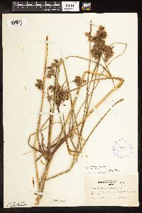 Scirpus cyperinus (L.) Kunth 407835[1106188]Lakela, Olga 93541949-08-13 United States, Minnesota, Saint Louis, Prairie Lake, SW St. Louis Co.;;050N;20W;, 46.809279 -92.870675 |
MIN:Plants | 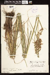 Scirpus cyperinus (L.) Kunth 412594[1106206]Moore, John; Moore, Marjorie 118331939-08-17 United States, Minnesota, Koochiching, Koochiching Co.; 1/2 mi east of Tilson Bay, Rainy Lake;;071N;22W;, 48.609164 -93.157413 |
MIN:Plants | 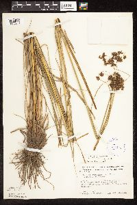 Scirpus cyperinus (L.) Kunth 413122[1106208]Moore, John; Moore, Marjorie 117631939-08-15 United States, Minnesota, Koochiching, Koochiching Co.; East of Black Bay Landing, Rainy Lake.;Voyageurs National Park;070N;22W;, 48.545336 -93.155756 |
MIN:Plants | 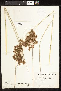 Scirpus cyperinus (L.) Kunth 419134[1106192]Ahlgren, Clifford 5441949-08-09 United States, Minnesota, Lake, Quetico-Superior Wilderness Research Center...Lake Co, S9 T64N R10W;Boundary Waters Canoe Area Wilderness / Superior National Forest;064N;10W;09, 48.01441 -91.6101 |
MIN:Plants | 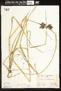 Scirpus cyperinus (L.) Kunth 419332[1106222]Briggs, John De Q.; Briggs, Marjorie 121945-08-02 United States, Minnesota, Cook, Sawbill Lake.;Boundary Waters Canoe Area Wilderness / Superior National Forest;062N;04W;, 47.845796 -90.829882 |
MIN:Plants | 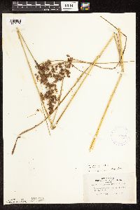 Scirpus cyperinus (L.) Kunth 420129[1106195]Lakela, Olga 119081950-09-01 United States, Minnesota, Saint Louis, Savanna River at Floodwood;;051N;20W;, 46.91894 -92.9176 |
MIN:Plants | 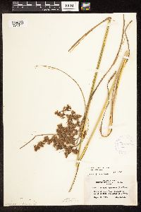 Scirpus cyperinus (L.) Kunth 420936[1106182]Lakela, Olga 122131950-09-22 United States, Minnesota, Saint Louis, Happy Lake, Hwy 73, S of Hibbing;;N;;, 47.353706 -92.998926 |
MIN:Plants | 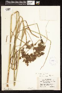 Scirpus cyperinus (L.) Kunth 421238[1106247]Lakela, Olga 120231950-09-06 United States, Minnesota, Saint Louis, Hwy 216 E of Hibbing;;N;;, 47.400906 -92.731472 |
MIN:Plants | 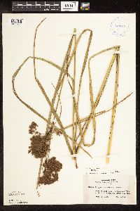 Scirpus cyperinus (L.) Kunth 421245[1106254]Lakela, Olga 120641950-09-06 United States, Minnesota, Saint Louis, Side Lake, at Sturgeon Lake N of Hibbing;;N;;, 47.658593 -93.050374 |
MIN:Plants | 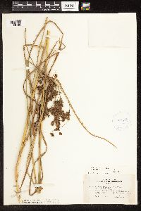 Scirpus cyperinus (L.) Kunth 421277[1106186]Lakela, Olga 120641950-09-06 United States, Minnesota, Saint Louis, Side Lake at Sturgeon Lake N of Hibbing;;N;;, 47.658593 -93.050374 |
MIN:Plants | 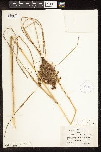 Scirpus cyperinus (L.) Kunth 421290[1106248]Lakela, Olga 121721950-09-10 United States, Minnesota, Saint Louis, Island Lake Resort on Hwy 73, S of Hibbing;;055N;21W;, 47.239418 -93.002014 |
MIN:Plants | 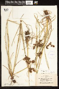 Scirpus cyperinus (L.) Kunth 421317[1106183]Lakela, Olga 93851949-08-14 United States, Minnesota, Saint Louis, Fredenberg Lake;;N;;, 46.987037 -92.191099 |
MIN:Plants | 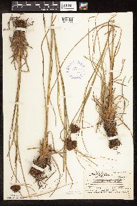 Scirpus cyperinus (L.) Kunth 421717[1106238]Ahlgren, Clifford 9901950-08-16 United States, Minnesota, Lake, Portage between Pine and Hula Lakes.;;N;;, 47.997822 -91.596867 |
MIN:Plants | 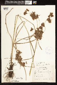 Scirpus cyperinus (L.) Kunth 423976[1106286]Emanuel, J. 3341946-09-11 United States, Minnesota, Itasca, County: Itasca. Locality: Nashwauk Township. Crooked Lake;;057N;24W;01, 47.450034 -93.333592 |
MIN:Plants | 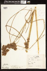 Scirpus cyperinus (L.) Kunth 424019[1106285]Emanuel, J. 1181946-09-03 United States, Minnesota, Itasca, Itasca County...Nashwauk Township - Bennett Mine;;057N;22W;30, 47.392162 -93.18511 |
MIN:Plants | 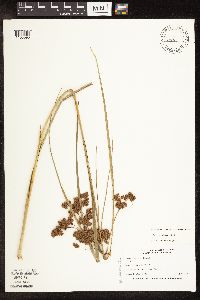 Scirpus cyperinus (L.) Kunth 428184[1106095]Nation, R. 94-4351994-07-24 United States, Minnesota, Mower, Tract 2. NW1/4 of NW1/4 of section;Lake Louise State Park;101N;14W;28, 43.522099 -92.518958 |
MIN:Plants | Scirpus cyperinus (L.) Kunth 433066[]Myhre, K. 60741995-08-11 United States, Minnesota, Aitkin, 3.5 miles southeast of the town of McGregor; south shore of starvation Lake. SE1/4 of SE1/4 of section;;047N;23W;08, 46.570016 -93.273089 |
MIN:Plants | 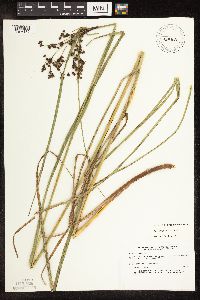 Scirpus cyperinus (L.) Kunth 433164[1106132]Myhre, K. 29541992-08-05 United States, Minnesota, Cass, Located one mile east of Lower Sucker Lake. SE1/4 of SE1/4 of section.;Chippewa National Forest / Leech Lake Indian Reservation;145N;29W;31, 47.33139 -94.406047 |
MIN:Plants | 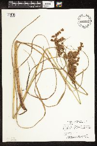 Scirpus cyperinus (L.) Kunth 433237[1106205]Myhre, K. 60531995-08-10 United States, Minnesota, Aitkin, Rice Lake National Wildlife Refuge. Aitkin Co.; Located one half mile north of Rice Lake in Rice Lake National Wildlife Refuge; Twin Lakes; T 47N R 24W NW1/ Aitkin Co.; Located one half mile north of Rice Lake in Rice Lake National Wildlife Refuge; Twin Lakes; T 47N R 24W NW1/4 of NW1/4 of Sec 27. 047N 24W 27, 46.526512 -93.358981 |
MIN:Plants | 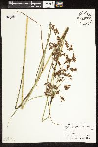 Scirpus cyperinus (L.) Kunth 433495[1106112]Myhre, K. 60091995-08-07 United States, Minnesota, Aitkin, Aitkin County...Located one half mile southwest of Dam Lake...northeast bay of Long Lake...T 46N R 25W NE1/4 of sE1/4 of Sec 3. 046N 25W 3, 46.498121 -93.48411 |
MIN:Plants | 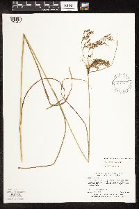 Scirpus cyperinus (L.) Kunth 439535[1106167]Myhre, K. 44531993-08-16 United States, Minnesota, Pine, 2.5 mi NE of the town of Nickerson; NW shore of Net Lake. NE1/4 of NE1/4 of section;Nemadji State Forest;045N;17W;02, 46.410448 -92.456597 |
MIN:Plants | 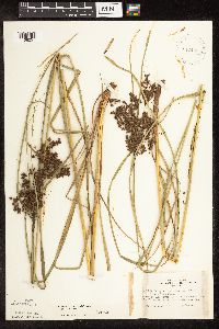 Scirpus cyperinus (L.) Kunth 442468[1106251]Lakela, Olga 133041951-07-17 United States, Minnesota, Saint Louis, Ash River, 2 mi down stream from the Frontier Lodge;Kabetogama State Forest;068N;19W;00, 48.368061 -92.774053 |
MIN:Plants | 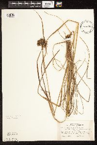 Scirpus cyperinus (L.) Kunth 443038[1106261]Lakela, Olga 136561951-08-26 United States, Minnesota, Lake, Back Bay Trail, Basswood Lake, Quetico-Superior Wilderness Center.;Boundary Waters Canoe Area Wilderness / Superior National Forest;064N;10W;09, 48.031651 -91.618862 |
MIN:Plants | 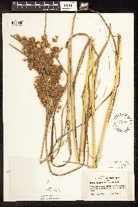 Scirpus cyperinus (L.) Kunth 443260[1106252]Lakela, Olga 137681951-09-13 United States, Minnesota, Saint Louis, Terrace of Crane Lake, the Congdon Resort.;Kabetogama State Forest;067N;17W;, 48.280155 -92.520857 |
MIN:Plants | 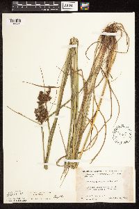 Scirpus cyperinus (L.) Kunth 445891[1106289]Moore, John 179161945-07-24 United States, Minnesota, Morrison, Along the shore of Fish Trap Lake at Lincoln.;;132N;31W;, 46.238341 -94.581982 |
MIN:Plants | 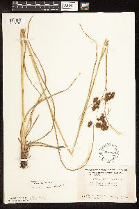 Scirpus cyperinus (L.) Kunth 449186[1106290]Moore, John; Hall, Robert 168881944-08-05 United States, Minnesota, Benton, 1 mi N of Sartell;;036N;31W;, 45.611141 -94.16239 |
MIN:Plants | 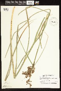 Scirpus cyperinus (L.) Kunth 455881[1106120]Lee, Michael MDL2511993-07-16 United States, Minnesota, Dakota, Dakota Co.; Lebanon Hills Regional Park, Holland Lake; T 27N R 19W NE1/4 of NE1/4 of Sec 34;Lebanon Hills County Park;027N;19W;34, 44.777188 -93.166885 |
MIN:Plants | 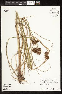 Scirpus cyperinus (L.) Kunth 455963[1106150]Smith, Welby 147031988-08-04 United States, Minnesota, Benton, Wisneski Wildlife Area. Benton County...Wisneski State Wildlife Management Area; about 5 miles due east of Rice. SE1/4 SE1/4 section 30, T 38N R 30W. 038N 30W 30, 45.7533333 -94.1166667 |
MIN:Plants | 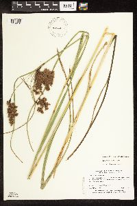 Scirpus cyperinus (L.) Kunth 456251[1106101]Myhre, K. 30601992-08-14 United States, Minnesota, Cass, One quarter mile southwest of Blackwater Lake. Plants growing along the north shore of Island Lake. NE1/4 of SE1/4 of section;;140N;29W;34, 46.899245 -94.331608 |
MIN:Plants | 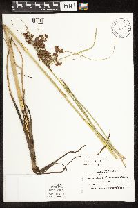 Scirpus cyperinus (L.) Kunth 458699[1106099]Lee, Michael MDL2871993-08-04 United States, Minnesota, Dakota, Chub Lake. SW1/4 of NE1/4 of section;;113N;20W;33, 44.551096 -93.227872 |
MIN:Plants | 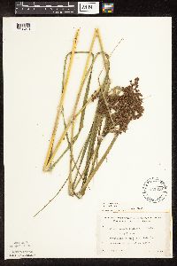 Scirpus cyperinus (L.) Kunth 462650[1106273]Lakela, Olga 146301952-07-08 United States, Minnesota, Saint Louis, Fox Island, Rainy Lake. Most northern part of the county.;Voyageurs National Park;071N;21W;, 48.625169 -92.962016 |
MIN:Plants | 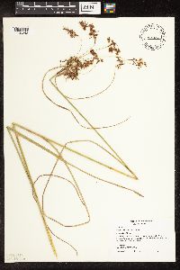 Scirpus cyperinus (L.) Kunth 467302[1106243]Smith, Michael 7011997-08-28 United States, Minnesota, Saint Louis, St Louis Co.; Daley Bay [Voyageurs NP] 48 25'03" N 92 56'12" W;Voyageurs National Park;069N;20W;, 48.455602 -92.896321 |
MIN:Plants | 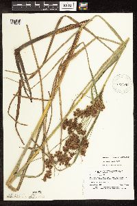 Scirpus cyperinus (L.) Kunth 475378[1106098]Lee, Michael MDL3161993-08-17 United States, Minnesota, Dakota, Inver Grove Heights. SW1/4 of SE1/4 of section;;027N;22W;22, 44.811867 -93.03436 |
MIN:Plants | 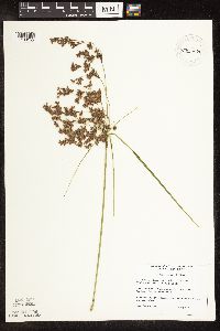 Scirpus cyperinus (L.) Kunth 475759[1106155]DeMink, L. 0101999-07-21 United States, Minnesota, Clearwater, Itasca State Park. Clearwater Co, Itasca State Park, Beaver Lake area. T143N, R36W, SW 1/4 of NW 1/4 of S17; NW corner of marshy pond edge Clearwater Co, Itasca State Park, Beaver Lake area. T143N, R36W, SW 1/4 of NW 1/4 of S17; NW corner of marshy pond edge across Wilderness Drive from Beaver Lake.. 143N 36W 17, 47.202536 -95.265597 |
Google Map
Google Maps is a web mapping service provided by Google that features a map that users can pan (by dragging the mouse) and zoom (by using the mouse wheel). Collection points are displayed as colored markers that when clicked on, displays the full information for that collection. When multiple species are queried (separated by semi-colons), different colored markers denote each individual species.